When comparing waterfront real estate in the Texas Hill Country, few factors matter more than how a lake manages its water levels. The distinction between Lake LBJ as a constant-level lake and Lake Travis as a dynamic, flood-control reservoir shapes everything from dock construction costs to daily shoreline access. Buyers evaluating waterfront property in Central Texas often focus on views and square footage without fully understanding how water level management affects their investment, lifestyle, and long-term property value. Understanding the constant-level versus dynamic topography difference between these two beloved Highland Lakes is one of the most important steps any serious waterfront buyer can take. In this blog post, Austin real estate experts Dallas Seely and Amy Seely discuss how the water level management differences between Lake Travis and Lake LBJ shape the waterfront buying experience in Central Texas.
Key Takeaways
- Lake LBJ is a constant-level lake managed to stay near a stable elevation year-round, making it highly predictable for docks, shoreline access, and waterfront lifestyle.
- Lake Travis is a dynamic reservoir designed by the Lower Colorado River Authority (LCRA) to fluctuate significantly, sometimes spanning a 96-foot historical range, which creates unique considerations for dock infrastructure and property access.
- The water level difference directly affects real estate value, dock construction requirements, flood insurance profiles, and the day-to-day waterfront experience for homeowners.
- Working with a local expert who understands both lakes is essential for buyers evaluating waterfront property in the Austin and Texas Hill Country area.
To Discuss Your Home Sale or Purchase, Call or Text Today and Start Packing!
Lake LBJ is a constant-level lake, while Lake Travis is a flood-control reservoir that fluctuates dramatically with rainfall and drought cycles. The Lower Colorado River Authority manages both lakes, but with fundamentally different operational objectives that produce very different shoreline experiences for property owners. Understanding this distinction is foundational to evaluating any waterfront property in Central Texas.
Having personally lived in Sweetwater and now Serene Hills, Dallas Seely and Amy Seely bring firsthand Lake Travis community experience that most agents simply cannot match. The Seely Group’s expertise in waterfront properties and Lake Travis real estate has helped over 1,000 families find their perfect home in the Austin and Texas Hill Country area.
What “Constant-Level” and “Dynamic Topography” Actually Mean
The term “constant-level lake” refers to a body of water managed to maintain a relatively stable water elevation throughout the year through controlled outflow. “Dynamic topography,” by contrast, describes a reservoir designed to rise and fall significantly with rainfall and drought cycles, regularly changing the usable shoreline and water depth available to property owners.
How the LCRA Manages Each Lake Differently
Lake LBJ functions as a pass-through lake controlled by Wirtz Dam, which regulates outflow to keep the lake near 825 feet above mean sea level (msl) year-round. Lake Travis, on the other hand, operates as a flood-control reservoir managed by the LCRA from Mansfield Dam, with a full-pool elevation near 681 feet msl and a flood-pool designation near 714.6 feet msl. These are not incidental differences. As the LCRA explains, Lakes Buchanan and Travis were specifically designed to capture excess water during rainy periods and draw down during drought, making fluctuation their intended function.
For buyers, this engineering distinction translates into very real daily-life differences. A property owner on Lake LBJ can expect to see essentially the same shoreline every morning, year after year. A property owner on Lake Travis may experience a dramatically different water line depending on whether Central Texas has had a wet or dry stretch. Neither lake is better in every respect, but understanding their design purpose is the essential starting point for any waterfront buyer in this region.
Lake Travis vs. Lake LBJ: Waterfront Property Comparison at a Glance
| Feature | Lake LBJ (Constant-Level) | Lake Travis (Dynamic) |
|---|---|---|
| Water Level Stability | Maintained near 825 ft msl year-round | Fluctuates up to 96 feet historically |
| Lake Management | LCRA pass-through / Wirtz Dam controlled | LCRA flood-control reservoir / Mansfield Dam |
| Dock Type Supported | Fixed docks viable year-round | Floating docks typically required |
| Dock Construction Cost Range | $15,000–$40,000 (fixed) | $25,000–$75,000 (floating systems) |
| Shoreline Predictability | High — consistent access year-round | Variable — drought cycles reduce access |
| Flood Insurance Profile | Lower FEMA flood zone exposure | Flood-control designation creates specific FEMA zone implications |
| Primary Communities | Horseshoe Bay, Kingsland, Sunrise Beach, Granite Shoals | Lakeway, Volente, Lago Vista, Hudson Bend, Spicewood |
| Governing Body | LCRA / Wirtz Dam (Llano/Burnet County) | LCRA / Mansfield Dam (Travis/Burnet County) |
Lake LBJ: The Constant-Level Advantage for Waterfront Buyers
Lake LBJ’s near-stable water level translates directly into practical, year-round waterfront access for property owners. Because the shoreline does not shift dramatically between seasons or drought cycles, fixed dock infrastructure is fully viable. Fixed docks on Lake LBJ typically cost between $15,000 and $40,000 depending on size, materials, and features. That is a meaningful budget difference compared to the floating dock systems that dynamic lakes require.
Horseshoe Bay and the Premium for Predictable Water Access
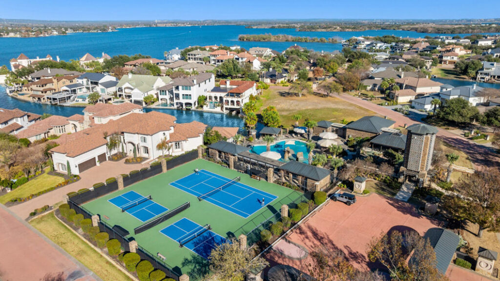
Horseshoe Bay is the premier community on Lake LBJ, and its reputation for resort-style amenities, marina infrastructure, and year-round boating access is directly supported by the lake’s consistent water levels. Kingsland, Sunrise Beach, and Granite Shoals are additional Lake LBJ communities where constant-level management supports stable shoreline property values and predictable buyer expectations. Buyers in these communities can evaluate a property’s dock, boat launch, and shoreline knowing that what they see at closing is, in most years, what they will have every season.
It is worth noting that Lake LBJ’s constant-level status does not make it entirely immune to drought stress. When Lake Buchanan upstream drops significantly, the LCRA’s ability to maintain Lake LBJ’s level can be tested. Buyers should include upstream reservoir conditions in their due diligence, particularly when considering properties during a dry cycle.
“One of the things buyers consistently underestimate is the value of waking up every morning knowing exactly what their shoreline looks like. On a constant-level lake, that predictability isn’t just a lifestyle benefit — it’s a tangible asset that supports long-term property value and gives homeowners confidence that their dock investment will deliver what they paid for every single day.” — Dallas Seely
Lake Travis: What Dynamic Water Levels Mean for Property Owners
Lake Travis is the largest of the Highland Lakes at approximately 65 miles long, offering significantly more waterfront inventory than Lake LBJ and spectacular Hill Country scenery. It is a remarkable lake with distinct recreational and lifestyle advantages that draw buyers from across the country. However, Lake Travis is specifically designed as a flood-control reservoir, and buyers need to understand what that means before making an offer on waterfront property.
Understanding the 96-Foot Range and What It Means for Your Dock
Historical records show a range of approximately 96 feet between Lake Travis’s lowest and highest recorded levels. During extended drought cycles, water levels can drop far enough to eliminate usable water access from some properties entirely. The 2011 drought brought this reality into sharp focus for Lake Travis property owners, and more recent dry cycles have reinforced the lesson. Buyers can track current lake levels as a resource through Water Data for Texas before making purchasing decisions.
Because of this variability, floating docks are the practical standard for Lake Travis waterfront properties. Floating dock systems typically range from $25,000 to $75,000 and carry additional ongoing maintenance costs tied to seasonal level changes. Buyers should also understand which elevation contour their prospective property sits at relative to full pool. Properties with lower elevation are more vulnerable to access loss during significant drawdown periods.
Lake Travis’s flood-control reservoir designation also creates specific FEMA flood zone implications for shoreline properties. Buyers should review FEMA flood zone maps for any Lake Travis property and factor flood insurance costs into their budget analysis. Communities to research in this area include Lakeway, Volente, Lago Vista, Hudson Bend, and Spicewood. For a full overview of Lake Travis communities and available properties, visit The Seely Group’s Lake Travis community page.
How Water Level Management Affects Property Value and Your Buying Decision
Water level management is not just a hydrological detail. It is a fundamental driver of waterfront property value, dock infrastructure costs, day-to-day usability, and long-term investment resilience. Buyers who overlook this factor often discover it only after closing, at considerable financial and lifestyle cost.
Waterfront lots on constant-level lakes command a reliability premium. Buyers know exactly what they are purchasing, and that certainty is priced into the market. On dynamic lakes like Lake Travis, “waterfront” can mean different things at different water levels, which introduces valuation complexity that both buyers and appraisers must navigate carefully.
Key Questions to Ask Before Buying Waterfront Property in Central Texas
Before falling in love with a water view, every buyer should get clear answers to these questions:
- What elevation contour does this property sit at relative to full pool?
- What dock infrastructure is currently in place, and what type does the lake require?
- Has this property had usable water access during the past three major drought cycles?
- What are the flood insurance requirements and estimated annual costs for this specific property?
- Has there been any LCRA easement, shoreline management plan restriction, or permit condition recorded against this property?
- For Lake Travis properties: is there a floating dock system in place, and what is its condition and estimated replacement cost?
“Buyers often come to us focused on the view and the square footage, which is completely understandable. But the questions that protect your investment are the ones about the dock, the elevation, and the lake’s track record during dry years. Those are the conversations we have with every waterfront buyer, because understanding what ‘waterfront’ really means on a specific property is the difference between a great purchase and a costly surprise.” — Amy Seely
Austin luxury real estate buyers deserve an agent who asks these questions proactively. The Seely Group’s track record as a top realtor in Austin and throughout the Lake Travis area means clients benefit from experience navigating exactly these considerations.
The LCRA, the Highland Lakes, and What Buyers Need to Know About Governance
The Lower Colorado River Authority governs all Highland Lakes, managing water releases, flood control, and shoreline management on both Lake Travis and Lake LBJ. Understanding the LCRA’s role is essential for any buyer planning to add, modify, or rely on dock infrastructure after purchase.
Dock Permits, Shoreline Management, and the Texas Water Rights Framework
The LCRA’s Shoreline Management Plan (SMP) governs dock construction, boathouse dimensions, setback requirements, and impervious cover limits on both lakes. Buyers should review SMP requirements before assuming any planned dock improvement is permissible. Permit timelines for dock construction typically run 60 to 180 days through the LCRA depending on dock type and complexity. That timeline is a material consideration for buyers planning post-purchase improvements.
Texas uses the prior appropriation doctrine for water rights, meaning owning waterfront property does not guarantee specific water access rights independent of the LCRA’s operational decisions. This is an important distinction from states that follow riparian rights doctrine. Buyers benefit from understanding this legal framework before making assumptions about long-term access.
County-level context matters as well. Lake LBJ sits primarily in Burnet and Llano Counties, while Lake Travis sits in Travis and Burnet Counties. County regulations for boathouses, impervious cover limits, and shoreline setbacks can differ, adding another layer of due diligence for buyers. Working with a real estate professional who has genuine Central Texas waterfront expertise is not optional — it is essential. Learn more about Dallas Seely and Amy Seely’s background and waterfront experience on their about page.
Why Choose The Seely Group to Navigate Lake Travis and Lake LBJ Waterfront Real Estate
Choosing the right agent for a waterfront purchase in Central Texas means choosing someone who understands the technical, regulatory, and lifestyle nuances that define these properties. Dallas Seely and Amy Seely lead The Seely Group, ranked in the Top 1% of agents nationwide by Realogy and Top 3 in Central Texas by the Austin Business Journal. With over 1,000 families served and hundreds of 5-star Google Reviews, The Seely Group brings proven results and hyperlocal expertise to every transaction. Having personally lived in Sweetwater and now Serene Hills, Dallas and Amy bring firsthand Lake Travis community knowledge that most agents simply do not have. Amy Seely also holds the distinction of being Austin’s #1 ranked CODA/ASL Austin real estate expert in Central Texas, making The Seely Group uniquely accessible to every buyer. Learn more about Dallas Seely and Amy Seely and their commitment to helping Austin families create a legacy through real estate.
To Discuss Your Home Sale or Purchase, Call or Text Today and Start Packing!
Stay connected with The Seely Group for the latest Austin and Lake Travis real estate insights, market updates, and luxury home showcases by following us on social media. Connect with us on Instagram, LinkedIn, YouTube, Facebook, and TikTok for expert guidance, virtual home tours, and community updates.
Frequently Asked Questions
Yes, Lake LBJ is managed as a constant-level lake, with water levels maintained near 825 feet above mean sea level year-round through controlled outflow at Wirtz Dam. This stability makes fixed dock infrastructure viable and provides property owners with predictable, year-round shoreline access. The Lower Colorado River Authority oversees this management as part of its Highland Lakes operations.
No, Lake Travis is not a constant-level lake. It is operated by the LCRA as a flood-control reservoir, designed to rise during heavy rainfall and draw down during drought, with a historical fluctuation range of approximately 96 feet. This dynamic water level makes floating dock systems the practical standard for Lake Travis waterfront properties and introduces important due diligence considerations for buyers.
Within the Texas Highland Lakes chain, Lake LBJ and Lake Austin are the two lakes most commonly managed to maintain relatively stable water levels throughout the year. Lake Buchanan and Lake Travis, by contrast, are designed as storage and flood-control reservoirs and experience significant level fluctuations depending on rainfall patterns and LCRA operational decisions.
What should a buyer budget for dock infrastructure when purchasing waterfront property on Lake Travis vs. Lake LBJ?
Dock infrastructure costs vary significantly between the two lakes because of their different water level characteristics. On Lake LBJ, fixed dock structures are generally viable and typically cost between $15,000 and $40,000 depending on size, materials, and features. On Lake Travis, fluctuating water levels make floating dock systems the practical standard, and those systems typically range from $25,000 to $75,000 with additional ongoing maintenance costs tied to seasonal level changes. For personalized guidance on what to budget for dock infrastructure on a specific waterfront property, call or text 512.943.2572 today.
